November finished with no measurable snowfall for just the ninth time since reliable records began in 1882. It's also the first time Denver will finish snow-free in the month since 2005, and just the second time since 1949.
Temperatures were also seven degrees above average for the month, making it the tenth-warmest November on record. This included a stunning 81-degree temperature on November 27, the warmest November temperature on record in our dear city.
In the nine seasons that had no measurable snowfall, eight finished with seasonal below-average snowfall. Of course, part of that has to do with losing November's 7.7-inch average snowfall, typically Denver's fifth-snowiest month of the year. But in those nine snow-free Novembers, seven had less December snowfall than average, too.
Winter's not dead, but this winter may end up with less snowfall than average, which could be caused by the current weak La Niña pattern in the Pacific.
A dominating "ridge" of high pressure kept us dry (we only recorded 0.29 inches of rain and snow in November, less than half of November’s average) and warm. The jet stream — the narrow ribbon of extremely strong winds about six miles up that dictates a lot of our weather — stayed to our north through most of November. This allowed warm air to consistently flow in from the south and west, and those winds tend to be drier as they roll down the Rockies and into Denver, drying and warming as they do so.

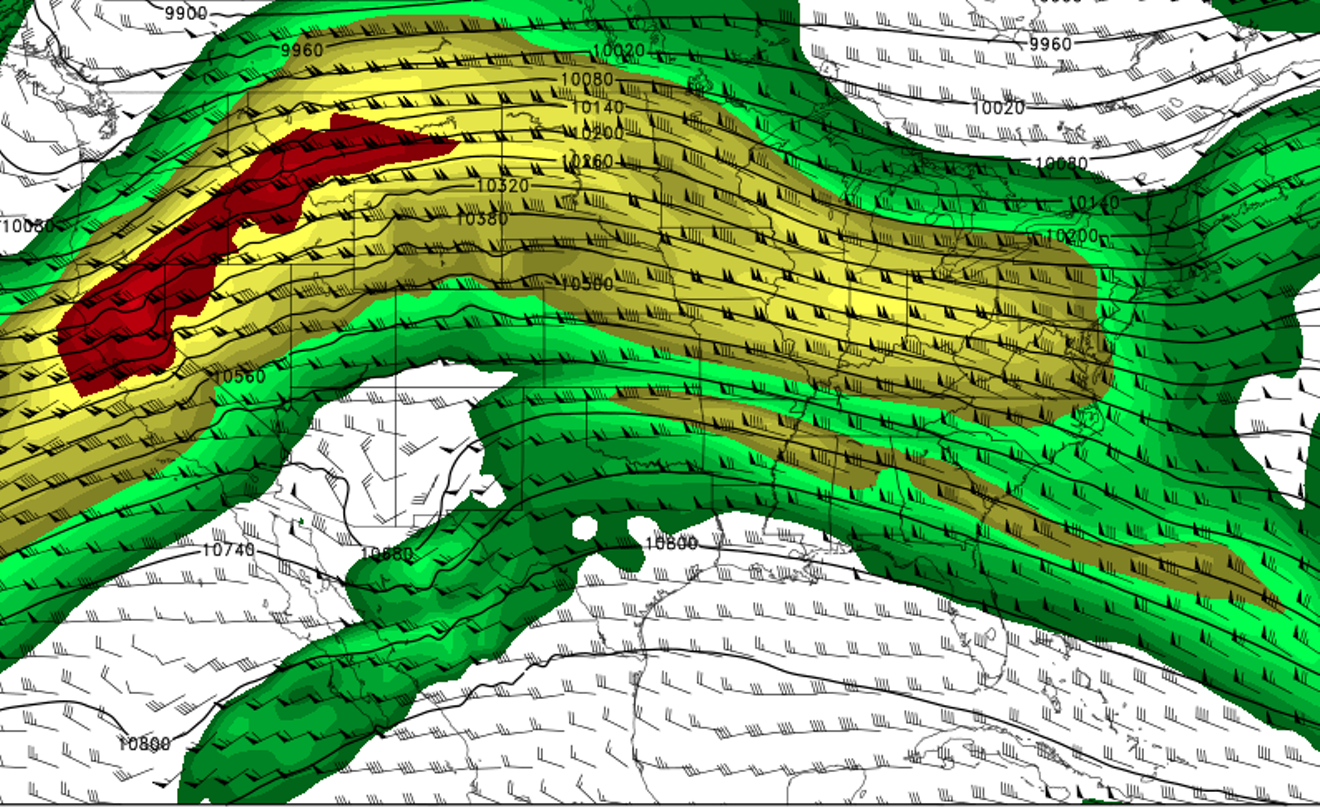
The primary jet stream pattern over Colorado that led to the warm November. The red and blue colors (strong winds) over Colorado kept us warm and dry.
College of DuPage Meteorology
Is climate change to blame for our current weather patterns? It's hard to say; climate change is best analyzed over longer time periods. And extreme temperatures — both warm and cold ones — will still happen, even in an overall warming environment. Denver’s third-coldest November temperature on record — negative 14 degrees — took place just three years ago, on November 13, 2014. Denver’s second-coldest overall November took place as recently as 2000. In other words, it’d be inaccurate to attribute this November’s warmth solely to climate change.
Enjoy the warmth while we have it. A major pattern switch is just around the corner, with chances for snow returning to Denver and the mountains this week.