
Photo by Evan Semón

Audio By Carbonatix
Advertising Can't Do It Alone
The challenges facing local news organizations are very real. That's why reader support matters more than ever. If you believe independent journalism matters, make a contribution today and help us reach our summer fundraising goal of $25,000 by August 9.
Much of Colorado is under a winter storm warning issued by the National Weather Service yesterday, November 7.
The NWS’s notice lasts from Friday, November 8, until midday Saturday, November 9, but the flakes are already falling across much of the forecast area, which runs from the Palmer Divide to Akron, Colorado, from west to east, and through Colorado Springs to the south and into Estes Park to the north.
The NWS had originally placed Denver under a winter storm watch, but conditions changed quickly, with projections rising from a few inches of snow in some parts of the Denver area to the entire area around and below Interstate 70 projected to get between seven and fourteen inches.
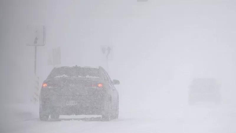
“Hazardous/difficult winter driving conditions are expected Friday well into Saturday,” the NWS notes on X.
November 7 saw moderate to heavy snow, with the peak coming during midday and tapering off into the evening before it’s expected to start back up again late Friday morning. The entire Denver area could now realistically see twelve inches of snow, however, and the NWS says there’s at least one day of snowfall left.
The snowstorm forecast was strong enough for Denver Public Schools to announce that all DPS schools will be closed on Friday, and other school districts in the metro are doing the same.
Along the Interstate 70 and Interstate 25 corridors, snow is expected to fall most of Friday. During the evening commute, snow is possible along I-25, and the NWS describes travel conditions as difficult.
“Denver metro will see mostly light snow this morning, but then a round of heavier snow is expected to develop Friday morning and continue through at least Friday night,” the NWS said.
In Denver, Boulder, Aurora and Centennial, the NWS expects potential major travel impacts from 6 p.m. on Friday to 9 a.m. on Saturday. The Palmer Divide and Eastern Plains could have major travel impacts today and tomorrow for most of the day.
The Denver area will see travel impacts lessen into Saturday evening, though there are still expected to be minor effects of winter weather on travel.