
Courtesy Adam Perry

Audio By Carbonatix
Keep Westword Free
We’re aiming to raise $20,000 by April 26. Your support ensures Westword can continue watching out for you and our community. No paywall. Always accessible. Daily online and weekly in print.
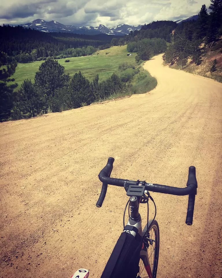
Ten years have passed since I graduated from commuting on a one-speed bike around my former home of San Francisco to cycling adventures in Switzerland, Germany, France, Belize, Belgium, Slovakia and elsewhere. But mostly, after moving to Boulder, I bike the Colorado Rockies. Why? Because they’re there.
If you can ride a bicycle and have access to either a great road bike or, really, any bike with generous gears, enjoy these ten scenic Front Range treks. To absolutely butcher and co-opt a phrase from Bilbo Baggins: It’s dangerous business going out your door, but if you step onto a bike, there’s no knowing where you might pedal off to.
Buffalo Bill’s Grave
Golden
The climb from downtown Golden up to Buffalo Bill’s grave is short and sweet, but it’s a classic local ride that’s regularly been a part of professional races. If you live in Denver, carefully head west about thirteen miles, past the Coors Brewery, then begin the winding climb up Lookout Mountain. It averages a 5 to 6 percent grade, so it’s not a particularly strenuous haul, but also not a casual spin. The base of the climb is directly west of downtown Denver, mostly on West 13th Avenue, but the way from the city includes some sketchy, unprotected roads – so make sure to enjoy a couple craft beers in Golden after the climb rather than before leaving Denver, if you indulge.
If you don’t live close by, park at a great Golden establishment such as New Terrain Brewing, grab your bike and make the approximately six-mile trek up Lookout Mountain, where you can check out Buffalo Bill’s grave and the corresponding tourist traps before soaring back down to Golden for a meal. Take some time to gaze at the view you’ve earned at the top. On a clear day, you can see an area of Colorado that’s bigger than some states.
The Big Easy
32088 US Highway 6, Golden
The Big Easy Trailhead is the perfect place for a family to embark on a lush bike ride along Clear Creek. Park at the trailhead and then get going, as virtually anyone able to ride a bike can complete the out-and-back on this quaint, gorgeous trail adjacent to Highway 6 west of Golden. If you’re a seasoned cyclist looking for a massive day out, avoid this four-mile trail, but it’s the perfect short ride if you want to get your kid or your partner or a friend into cycling. At just eight miles round trip, the Big Easy has some rolling hills but is really a breeze, with plenty of spots to stop for a picnic right by the creek.
Taking a breather after riding up Flagstaff on a vintage Italian bike.
Adam Perry
Flagstaff and Super Flagstaff
Boulder
As long as Colorado and bicycles both exist, cyclists from all over the world will continue testing their legs up Flagstaff Road in Boulder. I’ve done this ride almost a hundred times, so I must like it. From historic Chautauqua Park, it’s only about 2.5 miles up to Flagstaff Amphitheatre, where you’ll stumble upon a good number of weddings on summer weekends, but the switchbacks hammer you right off the bat in Gregory Canyon. After about a mile of fairly steep climbing, you’ll pass a vista point and the fancy Flagstaff House restaurant as the grade declines somewhat and you feel more a part of nature and separate from Boulder (aside from teenagers hotboxing in their parents’ cars and hikers in Patagonia gear crossing the road). The view from Flagstaff Amphitheatre is great, but the sweeping, spectacular views of the Flatirons and Chautauqua Park from some of the switchbacks on this ride are even better, and I’ve seen plenty of foxes on this climb, as well.
To achieve bragging rights and sore legs, ignore the Flagstaff Amphitheatre turnoff and keep on climbing all the way to the mailboxes above Lost Gulch, tackling the “Wall of Pain” and completing what’s known as Super Flagstaff. While the regular, well-known ride from basically anywhere in Boulder up to Flagstaff Amphitheatre is a fun challenge, if you’ve made it up and over the Wall of Pain, which has a gradient of well over 20%, and completed Super Flagstaff, it’s possible that there’s no hill anywhere that’s too steep for you.
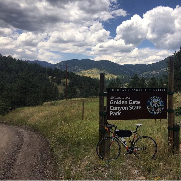
Golden Gate Canyon
Golden
Golden Gate Canyon State Park is a gorgeous area with great hiking, camping and biking just west of Highway 93 between Boulder and Golden. Your best bet for enjoying a bike ride through the park is driving to the intersection of Golden Gate Canyon Road and Highway 93, just west of North Table Mountain Park, and spinning uphill from there. Around the bend past Mt. Galbraith Park, you have two options: stay on Golden Gate Canyon Road or make a right onto Crawford Gulch Road, which turns into Drew Hill – not the ’90s R&B group, but rather a curvy mountain road that traverses dirt and pavement for a gritty sixteen miles toward the intersection of 119 and 46, between Black Hawk and Rollinsville.
I have biked through Golden Gate Canyon State Park, camped there and seen families of moose there, and it’s not only a great part of the Front Range to enjoy in the summer months, but also a good place to escape a hot day. My first time biking Golden Gate, I made the mistake of biking from Boulder on Highway 93, adding miles, heat and annoying, unsafe time in traffic. If you park at the intersection of Golden Gate Canyon Road and Highway 93 and head west on either Golden Gate or Crawford Gulch, you’ll get to enjoy the isolated serenity of the park and also end up in an area of Gilpin County that at least has convenience stores for snacks and, in my case, a poncho for the brief summer rainstorm I encountered. This approximately 35-mile loop will test your legs with over 5,000 feet of climbing, so while there are barely any directions to follow, make sure to pace yourself and stay hydrated.
U.S. 36 Bikeway
Between Denver and Boulder
The appearance of the blue-and-white signs for the Boulder/Denver bike path was celebrated widely by local cyclists in 2016. I had previously biked from Boulder to Denver often for concerts, sporting events and just beers with friends by taking Marshall Road out of Boulder, then making my way through Superior to traffic-laden Wadsworth Boulevard, eventually connecting with the Little Dry Creek Trail and wrapping all the way around Commerce City into Denver. The lack of a viable bikeway between Denver and Boulder meant that, before 2016, committed cyclists added over ten miles each way to the trip unless we wanted to get creative and spend most of the ride on streets not suitable, let alone safe, for biking.
Now, Boulder cyclists who want to pedal to the big city can jump on the U.S. 36 Bikeway behind the Table Mesa Park-N-Ride a few miles south of the University of Colorado and stay on it all the way to Westminster. The only real climb lasts for about half a mile, after passing Cherryvale Road, and then your legs essentially churn the rest of the way southeast into Denver, following signs for the Little Dry Creek Trail and eventually the South Platte River Trail.
The Google Maps app is solid for directing cyclists into Denver’s RiNo district and beyond after the U.S. 36 Bikeway dumps you onto Bradburn Boulevard in Westminster and you’re forced to traverse a few different local bike paths. If you’re on the U.S. 36 Bikeway on a summer weekend and see a dorky guy in a Rockies cycling jersey, it’s probably me. My favorite reason to do this ride between Boulder and Denver is to roll into a Rockies game on a Saturday or Sunday. It’s about a two-hour, 31-mile ride from downtown Boulder and, before the pandemic, the Rockies hosted numerous “Bike to the Game” days every season, complete with a secure, monitored bike depot, snacks and water for fans who biked to the game, and even giveaways for those who registered upon arrival.
Because of the pandemic, the Rockies have not hosted any Bike to the Game events since 2019, but a Rockies spokesperson told me by email recently that they could return this summer.
One of the best views on a Golden Gate Canyon bike ride.
Adam Perry
High Grade Road
Littleton
High Grade is the only ride on this list I haven’t tried yet, but the directions sound very simple, and the ride looks so amazing just from a Google search of photos that I’ll definitely give it a go this summer. The steepest switchbacks you’ll find on the High Grade ride range from 10 to 15 percent, and you’ll need plenty of water and snacks because you’ll pedal into a very remote landscape, but the journey – which is just over thirty miles – includes numerous more moderate sections, and you’ll earn some unforgettable views on the way from Chatfield State Park to Conifer, where you should at least be able to find an open gas station that sells cold drinks.
To begin this ride, park at the corner of South Wadsworth Boulevard and Deer Creek Canyon Road, a stone’s throw from Chatfield Reservoir. Near Pyramid Peak, make a left on 2991 (Deer Creek Road) rather than a right on South Deer Creek Canyon Road, and then the fun – if you consider pain fun – begins as you wind around Sampson Mountain on the way to Conifer, which is where you can finally rest before rolling back down toward Littleton.
The Gold Hill Inn
Boulder
The Wentworth Hotel began operating in Gold Hill, Colorado, about ten miles above Boulder, in 1872 and gradually became the Bluebird Lodge, which still operates in conjunction with the Gold Hill Inn, legendary in the area for hosting raucous local Americana music and, oh yeah, many-course gourmet dinners that are alone worth the trip. The two best ways to bike up to Gold Hill both begin in Boulder, but are very different. Either take the scenic, easy ride up the Boulder Creek Path to Fourmile Canyon, then climb pavement and eventually dirt up to Gold Hill, or test your legs past the rich folk on Mapleton Hill and then all the way up Sunshine Canyon, which will punish you for 9.5 miles all the way up to the door of the Gold Hill Inn.
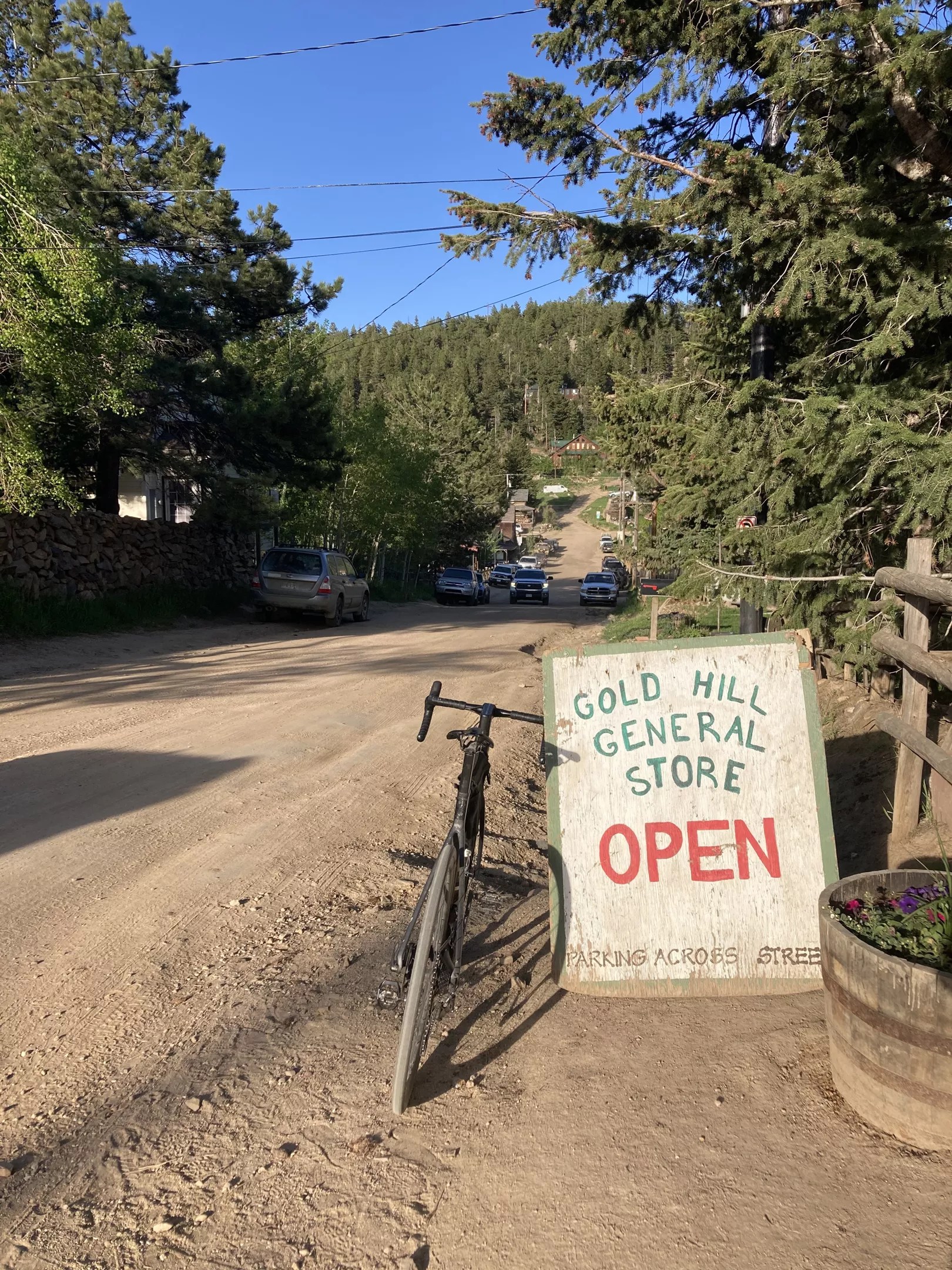
It’s all downhill on the way back, so celebrate with a cold beverage at the Inn and say hello to friendly owner Brian Finn. If the Inn is closed or dinner is sold out, head one block up Main Street to the revamped Gold Hill General Store & Pub, which has snacks for the road, plus pizza, pastries and booze.
Outside the Gold Hill Store and Pub on a recent ride.
Adam Perry
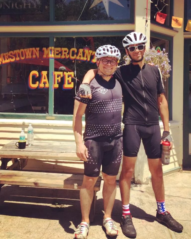
The Jamestown Mercantile and Super James
Jamestown
The Jamestown Mercantile and the Gold Hill Inn look very close to one another on a map, and both are family-run establishments that have been in business for over a hundred years – but there happen to be these things called mountains between them. Save yourself the insanity of biking up or even down infamous, treacherous Lickskillet Road, which I’ve climbed twice (and that’s plenty for a lifetime), by visiting the “Merc” and the Gold Hill Inn on different days. Like the Gold Hill Inn, there are numerous ways to reach the Jamestown Mercantile by bike, and many reasons to make the trek – from intimate performances by well-known local musicians to incredible, unique dinners, great wine and beer, and one of the best brunch menus in Colorado.
Like Highway 93, it’s best to avoid biking on U.S. 36 between Boulder and Lyons, as cars and big rigs fly up and down it at all hours and there have been numerous deadly accidents there involving cyclists, even on organized rides like the Ironman. A better idea for your first “Jimtown” ride is to begin anywhere in Boulder and head west into the foothills at the corner of Lee Hill Road and Broadway until Lee Hill becomes Old Stage Road. It’s a steep climb, but after half a mile, things ease up and you head down to Lefthand Canyon at Buckingham Park, which is a perfect mid-summer spot to dunk your whole head in cool Lefthand Creek before beginning your fairly mild six-mile climb up to the Jamestown Mercantile. On especially hot days, I always stop at Buckingham Park to fill my helmet with cold water from the creek and toss it right back on before getting back to pedaling.
Especially if you frequent the many stellar concerts in the park outside the Merc – and inside the Merc once the COVID coast is clear – a bike ride to Jamestown can feel like an episode of Cheers, where “everybody knows your name.” Wildlife is around, too: Just this month, I was biking back to Boulder and a baby bear crossed James Canyon Drive right in front of me as I descended; I’ve seen moose on the descent, as well. Hearty cyclists will stop at the Merc for a snack and/or a beer and then, instead of turning around and pointing their wheel toward Boulder, keep going up James Canyon Drive to the Peak to Peak Highway via Overland Road, a devastating route affectionately known as “Super James.”
The view from Overland Road after the climb out of Jamestown.
Adam Perry
Chapman Drive
Boulder
All but destroyed by the 2013 flood that ravaged the canyons around Boulder and destroyed numerous homes in the area, Chapman Drive reopened a couple years ago and is again a favorite for dirt-loving local cyclists. Parts of it are a sheet of ice in the winter and early spring, but for much of the year, the two-and-a-half-mile climb just up Boulder Canyon from the Alps Boulder Canyon Inn to Flagstaff Road is a dirt-lover’s paradise. The best way to enjoy this ride is to take the Boulder Creek Path west until it hits Canyon Road at Fourmile Canyon, then turn left on either Canyon Road or the soon-to-be-finished protected link from the creek path to the Chapman Drive Trailhead. Once you hit Flagstaff Road, the climb is over and you can relish the dreamlike views as you bomb down Flagstaff back to the city of Boulder.
Boulder cyclist Bob Sargent, of Savory Cuisines, grinding up Chapman Drive last year.
Adam Perry
Poorman’s Pass
Boulder
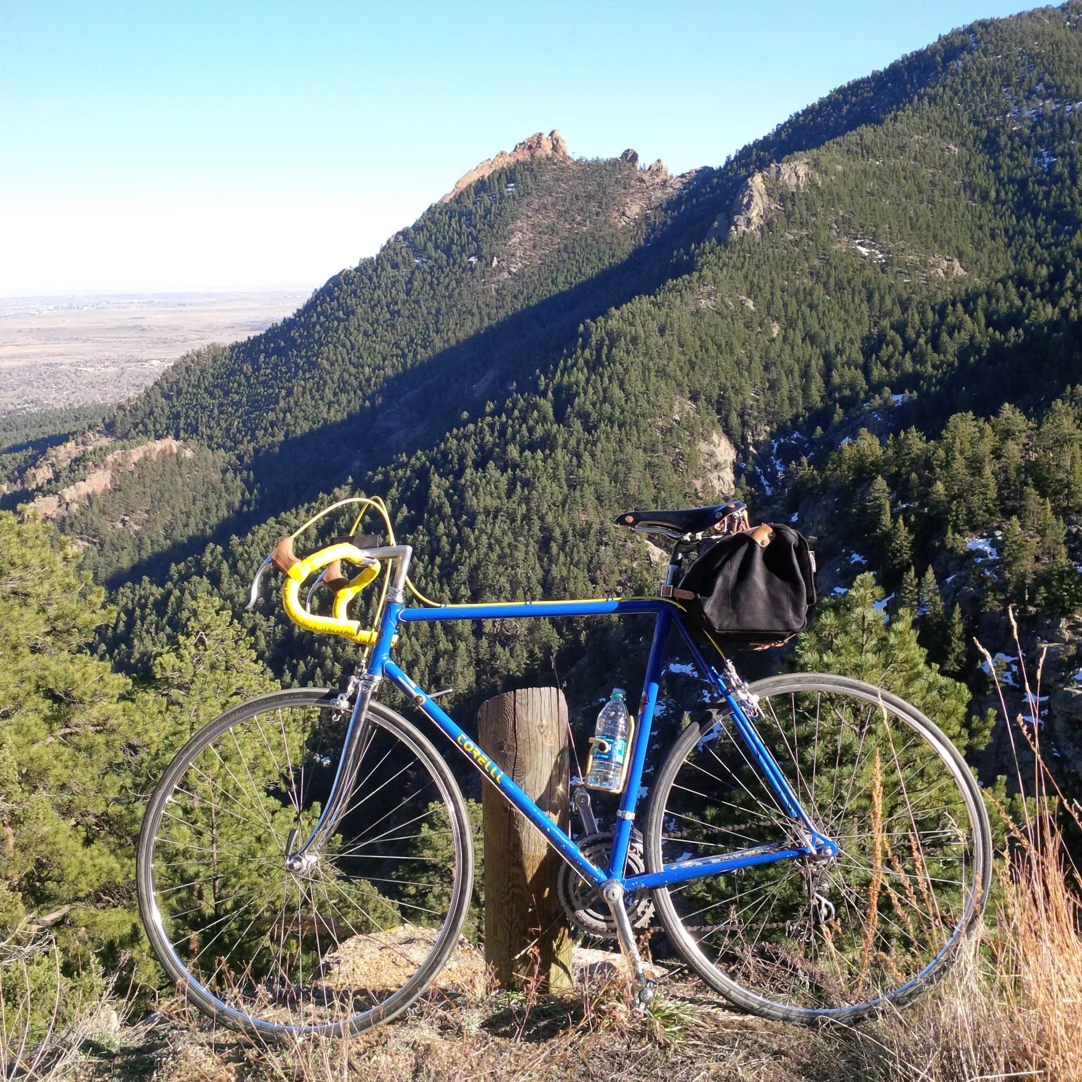
I’ve lived in Boulder for over a decade now, and my favorite bike ride on planet Earth is known as Poor Man’s Pass – partly because once the winter ice has melted, I can fit this ride into a lunch hour. From downtown Boulder, head west on the creek path until it ends at Fourmile Canyon. Carefully cross traffic on Canyon Road and then begin a pretty tame, gradual climb to Poorman Road, a steep one-mile patch of dirt connecting Fourmile Canyon with Sunshine Canyon. I’ve done this ride hundreds of times, on everything from a clunky old Torelli to a fat bike, and it’s become such a part of my life – climbing Poorman and coasting down idyllic Sunshine Canyon to Boulder – that it’s my wish to be buried somewhere on that quiet mile of dirt. Hopefully not very soon.