
Shutterstock/Darryl Brooks

Audio By Carbonatix
If April showers bring May flowers, then Colorado might have fewer flowers than usual this year.
Last month, the National Weather Service released a long-range seasonal and precipitation outlook showing Denver is likely to see precipitation below normal levels. Denver is on the cusp of seeing temperatures above normal in the months of March, April and May, too, according to the NWS.
Denver and Colorado were predicted to see a snowier winter than usual by the Farmer’s Almanac, which has held true so far – but the trend seems to be flipping in the spring.
The Four Corners area has a massive 50 to 60 percent chance to see precipitation below normal amounts, according to the NWS forecast map, while the entire state of Colorado has a likelihood of below-normal precipitation. Even the northeast corner of the state predicted to see the most moisture has a 33 to 40 percent chance of below-normal precipitation this spring.
Denver’s chances of below-normal precipitation are 40 to 50 percent, which could be great for those who tire of shoveling snow in March or April, but not so exciting for anyone worried about the possibility of drought.
Still, this is Colorado, and even chances of low precipitation this spring won’t prevent the random May snowstorm that always seems to hit right when everyone has pulled their summer clothes out of storage.
Higher temperatures are expected across some of Colorado, too. The southwestern corner of the state has a higher chance above-normal temperatures from March to May this year, while the NWS predicts the northeastern corner will see normal temperatures. Denver is closer to the normal side, the NWS map shows, but it’s right on the cusp, so higher-than=normal temperatures could reach Mile High City this spring, too.
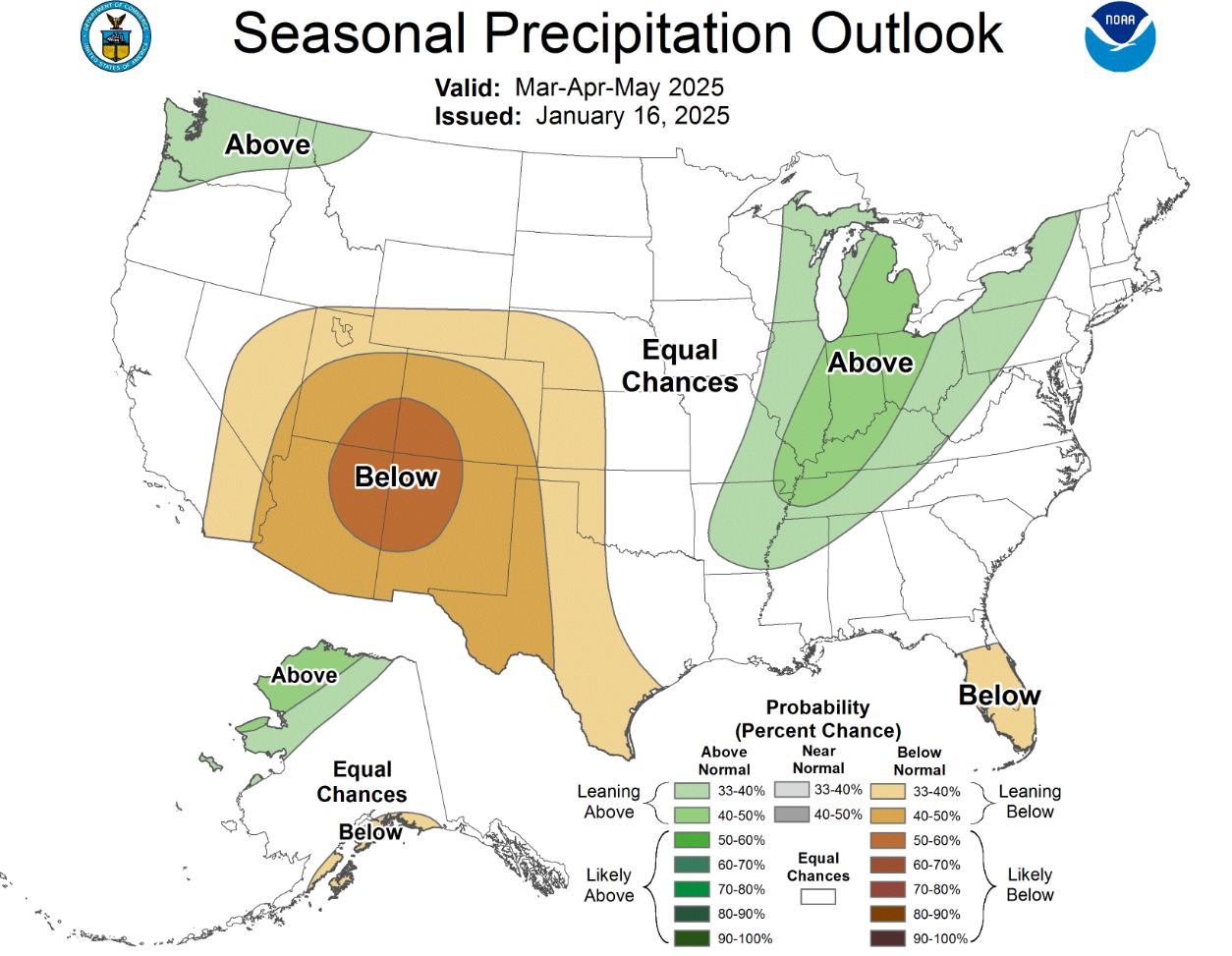
It’s likely that Denver will see lover-than-normal precipitation this Spring.
NWS Climate Prediction Center