
Satellite image ©2022 Maxar Technologies

Audio By Carbonatix
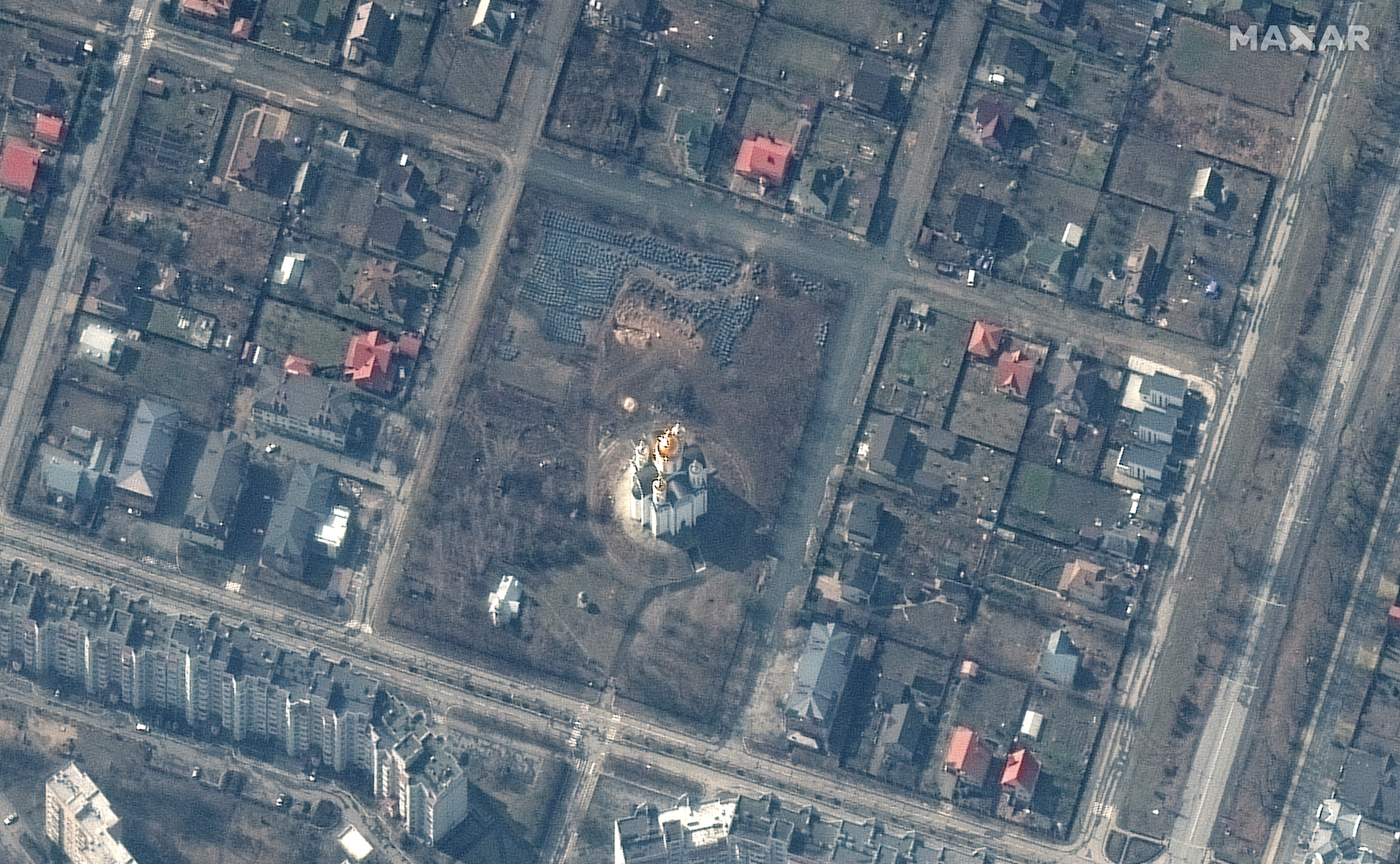
Pictures of a mass grave near a church in Bucha, Ukraine, have galvanized the world. Those images may have come from the sky, but they were captured by a company in Colorado.
From its headquarters in Westminster, Maxar is keeping the federal government informed about ground conditions in Ukraine. For the past two decades, the company has worked with the National Reconnaissance Office‘s EnhancedView program, which allows the NRO – which manages America’s spy satellites – to gain additional imagery from private outfits.
Maxar has an imaging satellite constellation constantly traversing the skies over Earth, capturing images. It doesn’t just document on-the-ground conflicts; it also catalogues damages after natural disasters, most recently releasing photographs of the aftermath of a tornado near New Orleans. It also documented the Ever Forward container ship, which is still stuck in Chesapeake Bay. According to an NRO spokesperson, commercial satellite imagery, including what Maxar provides, helps the government address both national security and disaster response challenges.
But lately, it’s been focused on Ukraine. In the early days of the invasion, Maxar satellites caught images of the convoy of Russian troops heading toward Kyiv; they later documented destruction in the port city of Mariupol. On March 31, Maxar satellites captured what appeared to be a mass grave.
Those photos, as well as eyewitness accounts of the discoveries, have set off international calls for action. The grave in Bucha apparently holds civilians, but Russia has characterized recent attacks on Bucha as a provocation faked by Ukraine rather than anything of its creation. The pictures tell a different story.
Along with the U.S. government, Maxar has partnered with private businesses and overseas allies including Ukraine to provide up-to-date images throughout the conflict. All of the imagery is unclassified.
The NRO pays Maxar $300 million a year to provide imaging along with other data-related services. “Maxar is one of three electro-optical commercial imagery providers on contract with the NRO and provides commercial imagery in support of NRO’s mission in providing data to more than 500,000 government users in the Intelligence Community, the Department of Defense, dozens of federal civil government agencies, allies, and mission partners,” says the NRO spokesperson.
Maxar is a combination of four companies that worked in space-related technology and merged in 2017. One of those companies, DigitalGlobe, already had its offices in Westminster; in 2018, it became headquarters for the entire company.
Maxar’s arrangement of satellites can take high-resolution images from a large range of locations, making it uniquely able to help with a “diverse set of national security missions,” according to the company. Its satellite constellation includes four satellites and collects images from over 3.8 million square kilometers each day. In addition, Maxar uses its satellites to help the United States intelligence community with three-dimensional data, object detection and data analytics. And its twenty years of imagery are archived, allowing for comparison over time.
Dan Jablonsky, CEO of Maxar, says one of the important parts of the company’s work is providing news organizations imagery that promotes transparency, helps reduce the spread of misinformation, and shows the realities on the ground in Ukraine.
“We are proud of our contributions to the public discourse around this tragic situation,” he says, “and will continue to share imagery to document the invasion and resulting humanitarian crisis.”