
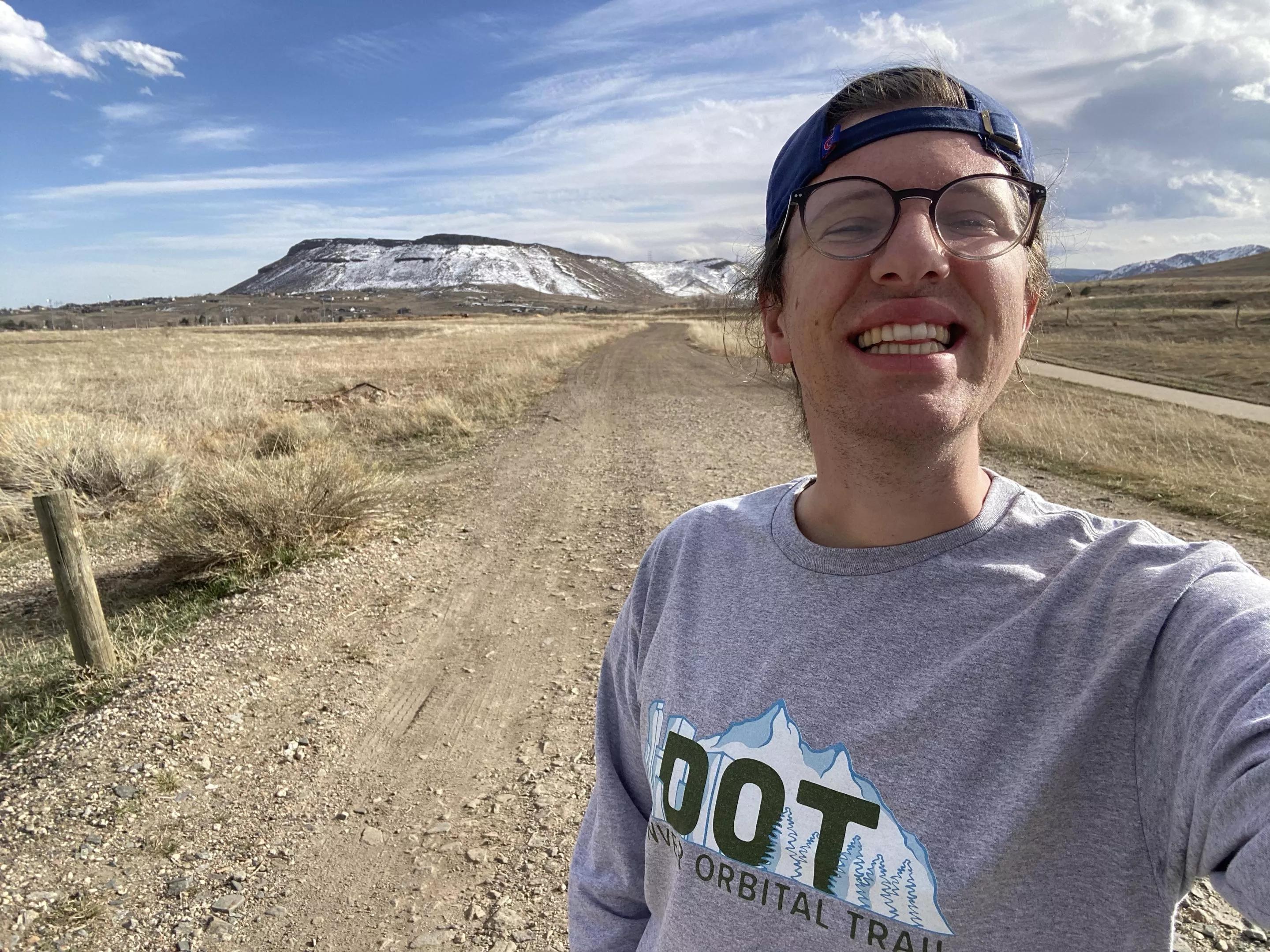
Michael Tormey/Denver Orbital Trail

Audio By Carbonatix
Independent Journalism in Denver Needs You
We need to raise $25,000 by August 9 to support the reporting our community depends on. Reader support keeps us independent and is playing a larger role in funding local journalism and shaping what comes next. If you believe independent local journalism matters, make a contribution today.
“I moved here in mid-June, and I was probably plotting the first drafts of the Orbital on day two or three of living here,” says Michael Tormey, founder of the 177-mile Denver Orbital Trail (DOT) that encircles the metro area. Comprising already existing paths, the loop is split into 28 segments of varying difficulties and lengths, from 2.4 to 11.7 miles.
Tormey completed his first segment in July and finished the thru-hike in October. As a newcomer to the area, his entire journey was one of discovery. But by bringing order to surrounding trails, parks and greenways, he hopes that even longtime locals can better understand and appreciate the region.
A former Boy Scout who grew up in rural Maine, Tormey spent recent years in Boston and London. While living abroad, he saw how popular urban hiking had become and walked several segments of the 150-mile London Loop – which, like the DOT, wraps the outskirts of the city.
After he relocated to Denver, Tormey says he was blown away by the trail systems that crisscross the metro area. Inspired, he began to draw a big circle, connecting paths that stretch as far as Thornton to Highlands Ranch and from Golden to Aurora.
“Every segment is really different and has something to love,” says Tormey. Some of the standouts: South Valley Park in Littleton, a part of segment five, and the Rocky Mountain Arsenal National Wildlife Refuge, which is segment eighteen – and a favorite urban hiking area. He also favors an incredible vista on segment 25 overlooking Standley Lake in Westminster, along with trails in Highlands Ranch that make up segments eight and nine.
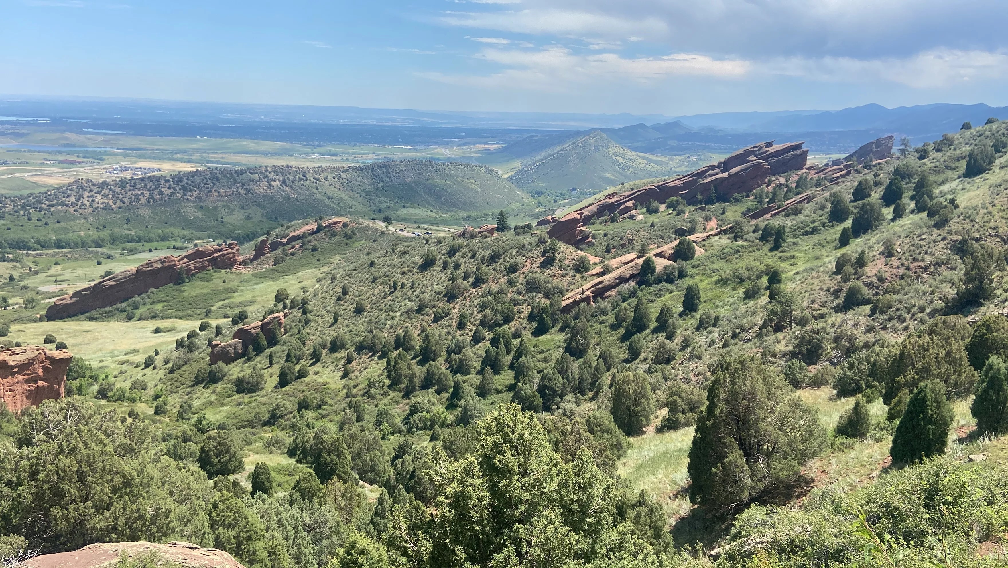
Views along segment two, which traverses Red Rocks Park.
Michael Tormey/Denver Orbital Trail
Each segment of the DOT is a point-to-point trail; walking out and back is reasonable with some stretches, such as segment three, which crosses through downtown Morrison and Bear Creek Lake Park. Three miles one way or six miles round trip, it could be a moderate day hike. But that’s not the case for segment one, a strenuous route that covers 11.2 miles of Front Range parks – and that’s one way.
“I really did my best to avoid dicey road crossings and road segments as much as possible,” Tormey says. “There are a handful here or there, especially along the Front Range.”
Given the challenges of point-to-point trails, Tormey has also mapped out 28 smaller loops that he calls sub-orbitals that utilize both the DPT and other paths. “You get a taste of the DOT area,” he explains, “but it is logistically simpler because they start and end in the same place.”
To help with logistics, Tormey provides public transit information for each segment on the DOT website. Where RTD connections are unavailable, he recommends using rideshare services to shuttle back to where you started. The DOT website offers printable segment maps and a sheet to track your thru-hike progress, as well.
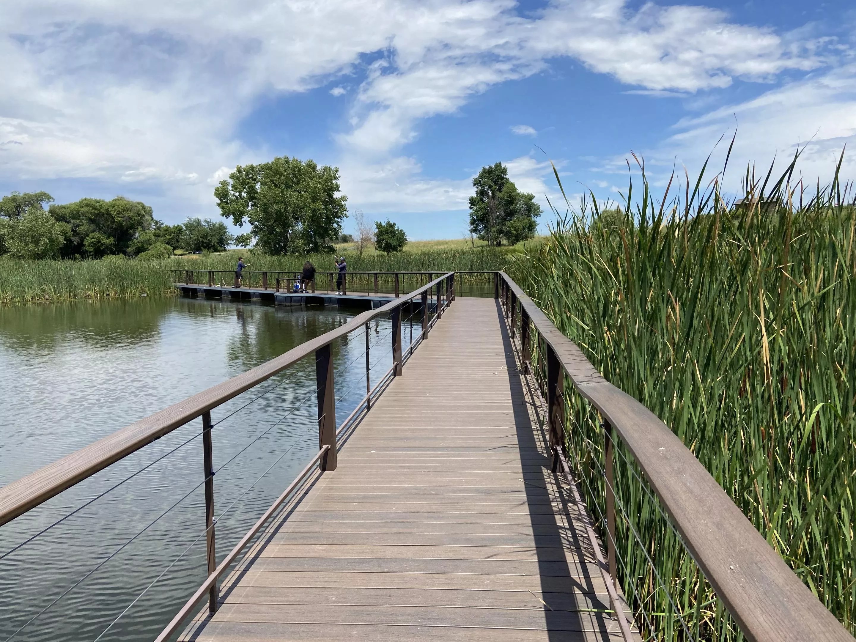
A waterfront walkway at Rocky Mountain Arsenal National Wildlife Refuge.
Michael Tormey/Denver Orbital Trail
Maps of the sub-orbitals and DOT segments are also available on AllTrails, which allows users to track navigation in real time; with a premium subscription, maps can be downloaded and used without cellular service. Tormey has requested that AllTrails approve the segments as official routes – at which point platform users will be able to rate them and leave comments. He’s also created downloadable GPX files of each segment, which can be uploaded to navigational apps like Ride With GPS and Strava.
Tormey has high praise for groups that work to maintain public paths, such as the High Line Canal Conservancy, Jefferson County Trails and City of Aurora Trails. The DOT “wouldn’t be possible without these organizations,” he says. “All I’ve done is draw a line on a map.”