

File photo

Audio By Carbonatix
The number of High Activity Location Observation, or HALO, cameras monitored by the Denver Police Department has more than doubled in the past seven years, making it more likely than ever that authorities are monitoring your activities at some of the Mile High City’s busiest places.
The data about HALO cameras was provided by the DPD, which initiated the surveillance program in connection with the 2008 Democratic National Convention. The following year, the department reconfigured the project, which provides 24/7 video feeds from what are considered high-crime areas within the city limits.
The idea is that potential offenders will think twice about committing misdeeds where they think their acts could be captured on video – and if they choose to do so anyhow, the images provide an important investigative clue to law enforcement.
In June 2011, when we published our first list of HALO camera locations, 102 of the devices were operational, with only a handful offering multiple views of the same setting. For instance, three cameras were installed on the campus of Lincoln High School, while Manual and Montbello high schools each sported four.
Times have changed. As you can see from the following list of HALO cameras in Denver, divided among the community’s six police districts, the cameras are currently mounted in 176 spots in Denver, including Mile High Stadium, the Pepsi Center and assorted parks.
But multiple cameras are cranking away at many sites, adding another fifty to the total. Two cameras can be found at or near a slew of major District 6 intersections not far from Civic Center Park, the Colorado State Capitol, the Denver Art Museum and the main branch of the Denver Public Library: 13th and Broadway, 13th and Acoma, 14th and Acoma, 1450 Lincoln and more.
By far the most HALO cameras are at the pedestrian bridge between 35th and 36th streets, which allows folks on foot to cross over railroad tracks between Blake and Wazee. The bridge, which opened in August 2017, boasts twelve of the gadgets.
The number of cameras in Denver may seem excessive, but plenty of communities are even more aggressive in regard to surveillance. Take Brighton, a much less populous burg than Denver, which has invested in 150 cameras and is currently encouraging residents to register their private security cams to broaden authorities’ view even further.
Continue to see where all 226 current HALO cameras in Denver can be found, complete with their GPS coordinates. We’ve also included some photos that show the cameras hiding in plain sight. One is screwed to a 7-Eleven sign. Another is affixed to the side of a Walgreens.
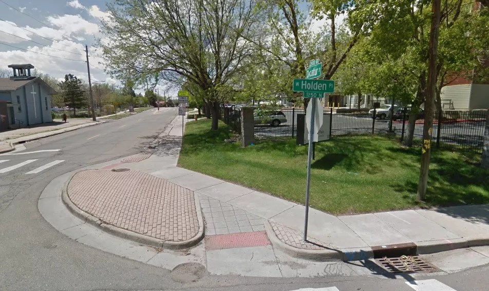
Where Decatur meets Holden Place.
Google Maps
DISTRICT 1
1. 1250 Decatur at Holden Pl.
GPS Location: 39.735735, -105.021693
2. 16th & Central
GPS Location: 39.758387, -105.009291
3. 10th & Federal
GPS Location: 39.732928, -105.025071
4. 38th & Lipan
GPS Location: 39.769391, -105.001876
5. Colfax & Perry
GPS Location: 39.740235, -105.039412
6. Federal & Howard Pl
GPS Location: 39.737880, -105.025394
7. Federal & Howard Pl
GPS Location: 39.737880, -105.025394
8. Broncos Field East
GPS Location: 39.743105, -105.016948
9. Broncos Field North
GPS Location: 39.746145, -105.022809
10. Broncos Field South
GPS Location: 39.740630, -105.019150
11. 13th & Decatur
GPS Location: 39.736437, -105.021861
12. 1155 Decatur
GPS Location: 39.734914, -105.021845
13. 11th & Decatur
GPS Location: 39.733947, -105.021880
14. 9th & Decatur
GPS Location: 39.731114, -105.021846
15. 900 Blk Alcott Way (Park)
GPS Location: 39.731902, -105.017581
16. 990 Alcott Way
GPS Location: 39.732623, -105.018128
17. Colfax & Federal Ramp
GPS Location: 39.739314, -105.024309
18. Pepsi Center Main Entrance
GPS Location: 39.747057, -105.008245
19. 12th & Chopper Cir
GPS Location: 39.749806, -105.005522
20. Pepsi Center NW Parking Lot
GPS Location: 39.749768, -105.007304
21. DPS DIST 1
32nd Clay North HS
GPS Location: 39.761945, -105.020628
22. DPS DIST 1
2900 Blk W. Douglas Pl. NHS
GPS Location: 39.760644, -105.023686
23. DPS DIST 1
2960 Speer Blvd. NHS Campus
GPS Location: 39.761257, -105.022839
24. DPS DIST 1
2960 Speer Blvd. NHS Campus
GPS Location: 39.761257, -105.022839
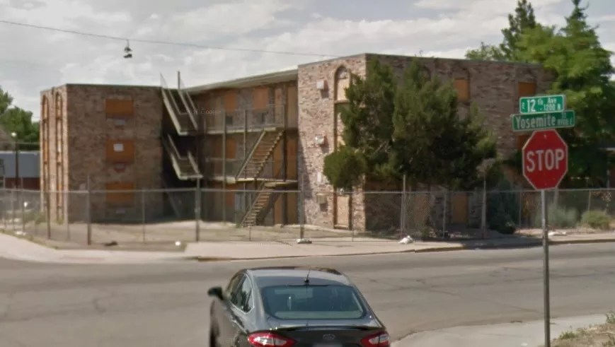
The intersection at 12th and Yosemite.
Google Maps
DISTRICT 2
25. 12th & Yosemite
GPS Location: 39.735524, -104.884788
26. 14th & Krameria
GPS Location: 39.738243, -104.916277
27. 2205 Colorado Blvd
GPS Location: 39.749484, -104.940895
28. 26th & Welton (2)
GPS Location: 39.753890, -104.979404
29. 27th & Welton
GPS Location: 39.754782, -104.978196
30. 33rd & Hudson
GPS Location: 39.763719, -104.924137
31. Bruce Randolph & Gilpin
GPS Location: 39.764576, -104.966997
32. Bruce Randolph & York
GPS Location: 39.764412, -104.959624
33. Colfax & Elm
GPS Location: 39.740275, -104.929737
34. Colfax & Josephine
GPS Location: 39.740014, -104.958719
35. Colfax & Krameria
GPS Location: 39.740286, -104.916148
36. Colfax & St. Paul
GPS Location: 39.740079, -104.950776
37. Colfax & Valentia
GPS Location: 39.740044, -104.892205
38. Colfax & Verbena
GPS Location: 39.740046, -104.890436
39. Colfax & Xanthia
GPS Location: 39.740044, -104.886298
40. 35th St. Blake Bridge (12)
GPS Location: 39.769138, -104.975688
41. DPS DIST 2
1651 E. 26th Ave. Manual HS
GPS Location: 39.754561, -104.967792
42. DPS DIST 2
1751 E. 28th Ave. Manual HS
GPS Location: 39.757005, -104.965952
43. DPS DIST 2
2655 N. Williams Manual HS
GPS Location: 39.755983, -104.965949
44. DPS DIST 2
2795 N. Williams Manual HS
GPS Location: 39.756993, -104.965955
45. DPS DIST 2
2675 E. Colfax East HS
GPS Location: 39.740230, -104.955720
46. DPS DIST 2
16th & Esplanade East HS
GPS Location: 39.741623, -104.956743
47. DPS DIST 2
North Parking Lot & Track East HS
GPS Location: 39.742911, -104.958547
48. DPS DIST 2
South Parking Lot & Track East HS
GPS Location: 39.742433, -104.958783
49. DIST 2 PARKS
Curtis Park (4)
GPS Location: 39.761049, -104.976637
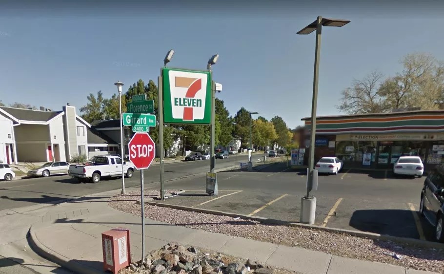
The HALO Camera at 10010 East Girard is mounted on a 7-Eleven sign.
Google Maps
DISTRICT 3
50. 10010 E Girard
GPS Location: 39.654360, -104.871922
51. 890 S Monaco
GPS Location: 39.701050, -104.911405
52. University & Cherry Creek Dr N
GPS Location: 39.716092, -104.959026
53. 000 Block University
GPS Location: 39.718258, -104.959104
54. 1st Ave & Milwaukee
GPS Location: 39.718155, -104.952193
55. Ellsworth & Steele
GPS Location: 39.716260, -104.949903
56. 725 S Pennsylvania – Parking
GPS Location: 39.703654, -104.981955
57. 725 S Pennsylvania – Alley
GPS Location: 39.703654, -104.981955
58. Pennsylvania & Exposition
GPS Location: 39.703961, -104.981596
59. Western Union Bellview-Quebec
GPS Location: 39.624117, -104.903917
60. Western Union Chenenga-Olive
GPS Location: 39.625450, -104.905533
61. Western Union Chenenga-S. Quebec
GPS Location: 39.625567, -104.904200
62. Western Union Mid Block S. Quebec
GPS Location: 39.624700, -104.904183
63. Western Union Bellview-Olive
GPS Location: 39.624217, -104.905283
64. Western Union MidBlock-Olive
GPS Location: 39.624800, -104.905533
65. DPS DIST 3
Virginia & Krameria – GWHS
GPS Location: 39.707533, -104.916430
66. DPS DIST 3
Leetsdale & Exposition – GWHS
GPS Location: 39.703889, -104.914773
67. DPS DIST 3
Monaco & Exposition – GWHS
GPS Location: 39.703860, -104.912917
68. DPS DIST 3
500 Blk S Monaco – GWHS
GPS Location: 39.705899, -104.912845
The HALO camera at the right is mounted on a Walgreens at 300 South Federal.
Google Maps
DISTRICT 4
69. 300 S Federal
GPS Location: 39.710153, -105.025078
70. Alameda & Zuni
GPS Location: 39.711188, -105.015729
71. Mississpippi & Raritan
GPS Location: 39.696765, -105.009369
72. DPS DIST 4
Iliff & Hazel – Lincoln HS
GPS Location: 39.675013, -105.025052
73. DPS DIST 4
2175 S Hazel Ct – Lincoln HS
GPS Location: 39.677111, -105.027897
74. DPS DIST 4
2165 S Federal – Lincoln HS
GPS Location: 39.677448, -105.025071
75. DPS DIST 4
2285 S Federal – Lincoln HS
GPS Location: 39.676008, -105.026625
76. DPS DIST 4
6400 Blk W Brown Pl – Kennedy HS
GPS Location: 39.663334, -105.067333
77. DPS DIST 4
6500 Blk W Dartmouth – Kennedy HS
GPS Location: 39.660259, -105.071244
78. DPS DIST 4
Dartmouth & Lamar – Kennedy HS
GPS Location: 39.659787, -105.067289
79. DPS DIST 4
Brown Pl & Lamar – Kennedy HS
GPS Location: 39.663333, -105.067299
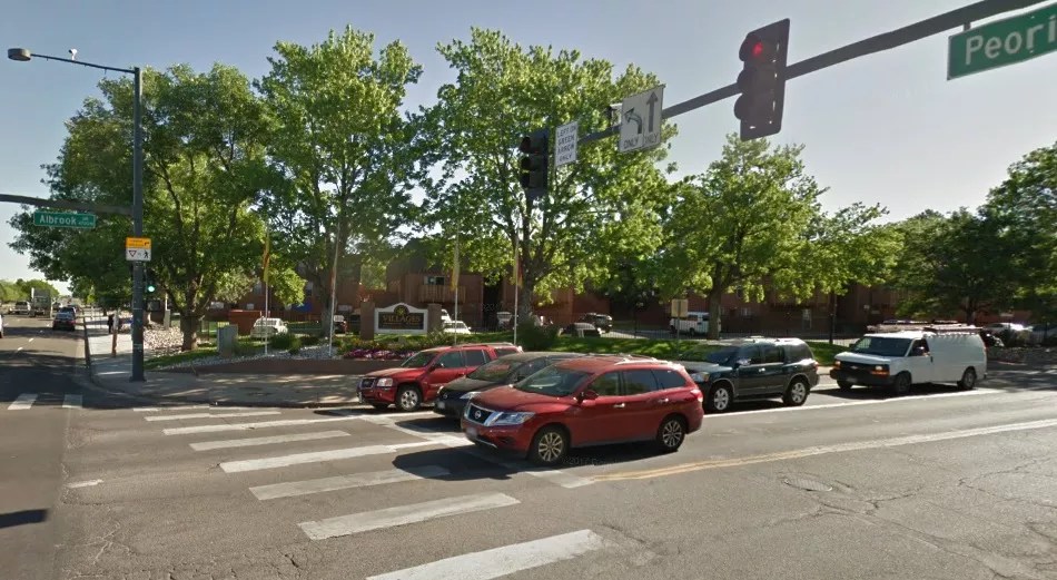
The intersection of Albrook and Peoria.
Google Maps
DISTRICT 5
80. Albrook E of Peoria
GPS Location: 39.782138, -104.845586
81. 3900 Blk N Peoria
GPS Location: 39.772052, -104.846993
82. 40th & Chambers
GPS Location: 39.773247, -104.809737
83. GVR & Chambers
GPS Location: 39.783786, -104.809703
84. 47th & Peoria
GPS Location: 39.782398, -104.847022
85. DPS DIST 5
51st & Bolling Drive – Montbello HS
GPS Location: 39.787016, -104.824782
86. DPS DIST 5
Stoll Place & Bolling – Montbello HS
GPS Location: 39.784868, -104.823570
87. DPS DIST 5
4875 N Crown Blvd – Montbello HS
GPS Location: 39.784340, -104.831212
88. DPS DIST 5
5025 N Crown Blvd – Montbello HS
GPS Location: 39.787057, -104.829330
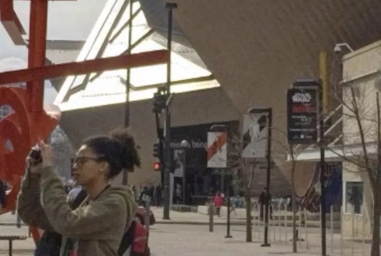
A Denver HALO camera seen at the upper right captures the scene in a different way than the photographer on the left.
Google Maps
DISTRICT 6
89. Art Museum E
GPS Location: 39.740330, -104.990545
90. Art Museum W
GPS Location: 39.740330, -104.990545
91. 12th & Welton
GPS Location: 39.740862, -104.995453
92. 1351 Cherokee
GPS Location: 39.737973, -104.991927
93. 13th & Cherokee
GPS Location: 39.737081, -104.991374
94. 13th & Delaware
GPS Location: 39.736975, -104.992769
95. 13th & Welton
GPS Location: 39.741876, -104.994304
96. 13th & Broadway (2)
GPS Location: 39.736873, -104.987414
97. 13th & Acoma (2)
GPS Location: 39.736837, -104.988820
98. 14th & Acoma (2)
GPS Location: 39.737811, -104.988836
99. 1450 N Broadway
GPS Location: 39.739249, -104.987496
100. 1450 Lincoln (2)
GPS Location: 39.739282, -104.986187
101. 1451 Larimer (2)
GPS Location: 39.748271, -104.998628
102. 1451 Market (2)
GPS Location: 39.748717, -104.999798
103. 14th & Curtis
GPS Location: 39.745510, -104.996893
104. 14th & Champa
GPS Location: 39.744735, -104.996281
105. 14th & Welton
GPS Location: 39.742656, -104.993749
106. 14th & Stout
GPS Location: 39.744017, -104.995444
107. 14th & Bannock
GPS Location: 39.738442, -104.990251
108. 14th & Elati
GPS Location: 39.738464, -104.994104
109. 14th & Larimer (2)
GPS Location: 39.748296, -104.998602
110. 14th & Broadway (2)
GPS Location: 39.738444, -104.987411
111. 14th & Champa
GPS Location: 39.744664, -104.996308
112. 14th & Welton
GPS Location: 39.742647, -104.993690
113. 14th & Market (2)
GPS Location: 39.748018, -105.000701
114. 15th & Curtis
GPS Location: 39.746277, -104.995991
115. 15th & Champa (2)
GPS Location: 39.745609, -104.995127
116. 15th & California
GPS Location: 39.744301, -104.993357
117. 15th & Larimer (2)
GPS Location: 39.748289, -104.998630
118. 15th & Market (2)
GPS Location: 39.748939, -104.999470
119. 15th & Welton
GPS Location: 39.743623, -104.992452
120. 15th & Wazee
GPS Location: 39.750260, -105.001211
121. 16th & Arapahoe (2)
GPS Location: 39.747877, -104.995640
122. 16th & Blake (2)
GPS Location: 39.750542, -104.999162
123. 16th & California (2)
GPS Location: 39.745216, -104.992173
124. 16th & Champa (2)
GPS Location: 39.746543, -104.993927
125. 16th & Chestnut (2)
GPS Location: 39.753947, -105.003400
126. 16th & Cleveland (2)
GPS Location: 39.741862, -104.987823
127. 16th & Court (2)
GPS Location: 39.742534, -104.988665
128. 16th & Curtis (2)
GPS Location: 39.747212, -104.994786
129. 16th & Glenarm (2)
GPS Location: 39.743859, -104.990404
130. 16th & Larimer (2)
GPS Location: 39.749857, -104.998270
131. 16th & Lawrence (2)
GPS Location: 39.748545, -104.996530
132. 16th & Market (2)
GPS Location: 39.749896, -104.998290
133. 16th & Stout (2)
GPS Location: 39.745860, -104.993011
134. 16th & Tremont (2)
GPS Location: 39.743224, -104.989536
135. 16th & Wazee (2)
GPS Location: 39.751212, -105.000050
136. 16th & Welton (2)
GPS Location: 39.751212, -105.000050
137. 16th & Wewatta (2)
GPS Location: 39.753291, -105.002608
138. 16th & Wynkoop (2)
GPS Location: 39.751892, -105.000915
139. 16th & Tremont
GPS Location: 39.743198, -104.989535
140. 17th & Arapahoe
GPS Location: 39.748794, -104.994413
141. 17th & Broadway
GPS Location: 39.743453, -104.987425
142. 17th & Tremont
GPS Location: 39.744101, -104.988364
143. 18th & Arapahoe
GPS Location: 39.749730, -104.993251
144. 1950 Blake (2)
GPS Location: 39.753745, -104.995040
145. 1950 Market (2)
GPS Location: 39.753184, -104.994029
146. 19th & Blake
GPS Location: 39.753365, -104.995558
147. 19th & Market
GPS Location: 39.752713, -104.994684
148. 20th & Blake
GPS Location: 39.754338, -104.994303
149. 20th & Larimer (2)
GPS Location: 39.752944, -104.992581
150. 20th & Market
GPS Location: 39.753645, -104.993428
151. 2283 19th St – Skate Park
GPS Location: 39.759726, -105.002798
152. 22nd & Lawrence
GPS Location: 39.754154, -104.989279
153. 2300 Blk Welton
GPS Location: 39.751091, -104.982851
154. 23rd & Lawrence (2)
GPS Location: 39.755094, -104.988091
155. 24th & California
GPS Location: 39.752680, -104.982515
156. 24th & Welton
GPS Location: 39.752012, -104.981662
157. 600 Blk 24th St – Alley
GPS Location: 39.752341, -104.982073
158. Colfax & Broadway
GPS Location: 39.740099, -104.987427
159. Colfax & Clarkson
GPS Location: 39.740006, -104.977626
160. Colfax & Cleveland
GPS Location: 39.740603, -104.988845
161. Colfax & Corona
GPS Location: 39.739986, -104.974142
162. Colfax & Downing
GPS Location: 39.739979, -104.973035
163. Colfax & Emerson
GPS Location: 39.740014, -104.976487
164. Colfax & Gilpin
GPS Location: 39.740025, -104.967238
165. Colfax & Grant
GPS Location: 39.740044, -104.983613
166. Colfax & Lafayette
GPS Location: 39.739998, -104.970754
167. Colfax & Logan
GPS Location: 39.740032, -104.982357
168. Colfax & Marion
GPS Location: 39.740012, -104.971893
169. Colfax & Ogden
GPS Location: 39.740046, -104.974794
170. Colfax & Pearl
GPS Location: 39.740032, -104.979922
171. Colfax & Pennsylvania
GPS Location: 39.740024, -104.981105
172. Colfax & Race
GPS Location: 39.740002, -104.963466
173. Colfax & Vine
GPS Location: 39.739992, -104.962246
174. Colfax & Washington
39.740017, -104.978767
175. Colfax & Williams
39.740008, -104.966006
176. HQ Plaza North
39.737600, -104.992065