
Montrose Fire-Rescue

Audio By Carbonatix
A massive wildfire dubbed the “416 fire” has raged for fourteen days in southern Colorado. According to the most recent report from the Rocky Mountain Incident Management Team, the fire has consumed nearly 30,000 acres and is only 15 percent contained.
Below is the latest map of the blaze in the San Juans. Though Governor John Hickenlooper tried to reassure tourists on Wednesday that it is still safe to travel to Durango, the fire is within thirteen miles of the city as of today, June 14. According to the latest report, 24 fire crews, 55 engines, eight bulldozers and twelve tankers are fighting the blaze.
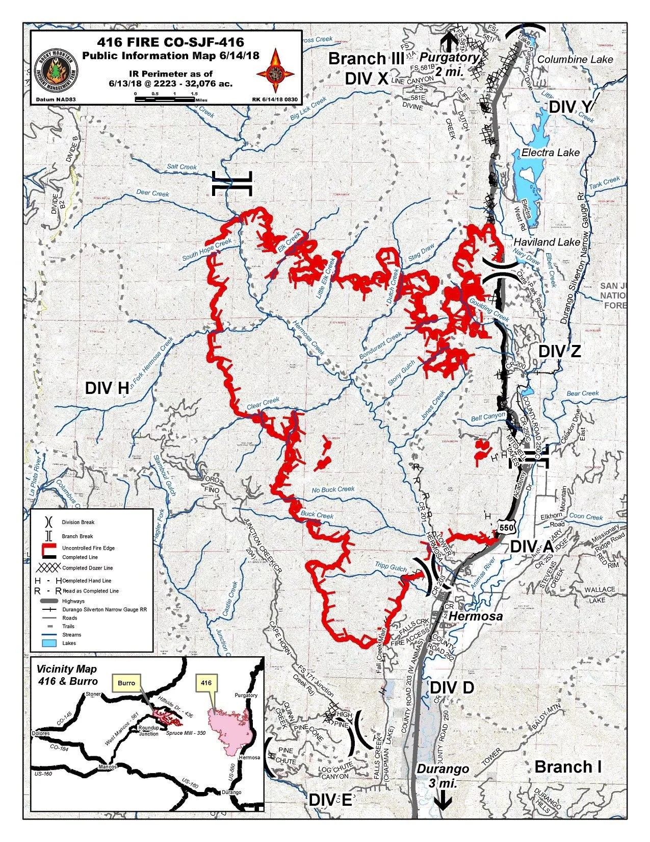
A map of the 416 Fire as of 8 a.m. on June 14
Rocky Mountain Incident Management Team
The 416 fire isn’t the only wildfire that fire crews have to contend with in southern Colorado; nearby, in an even more remote section of the San Juans, the “Burro” fire has consumed approximately 2,800 acres of forest land, according to a report issued Wednesday, June 13.
Because of possible thunderstorms, that National Weather Service issued a flash flood warning this morning for the areas around the fires. They’re also concerned about mudslides. Up-to-date information on the 416 fire can be found here.
Here are some of the most striking images of the fire posted on Twitter:
America's #Wildfires are getting bigger and more dangerous every year due to increasing drought in the western U.S from global warming and the current #UnitedStates administration is fully denying the existence of Global Warming.
( This is the #416Fire 23,000 acres in Colorado ) pic.twitter.com/YNnFnL5hwI— Deven (@Deven_Socal) June 13, 2018
#416Fire #Durango pic.twitter.com/xDOMQers4R
— Cookie Cooke??? (@OBXHippieChick) June 14, 2018
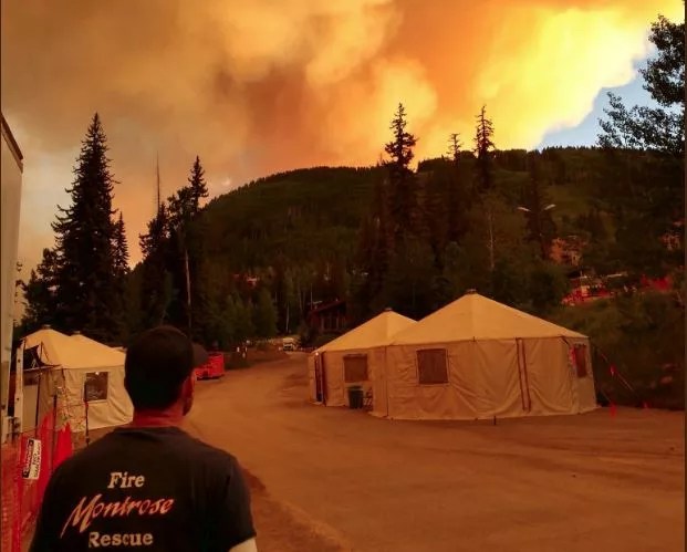
MFPD wildland crew at 416 Fire. pic.twitter.com/1WfQR2GG21
— Montrose Fire-Rescue (@MontroseFPD) June 12, 2018
#416Fire Update: 24 people stayed inside the #RedCross shelter inDurango while more than 70 were outside in tents. See our blog story at https://t.co/XwKoxOBKBg #COFire pic.twitter.com/tzcfnZlBYL
— CO & WY Red Cross (@COWYRedCross) June 14, 2018
View of the #416Fire tonight from incident command. pic.twitter.com/jF0qjWTt7j
— WestMetroFire (@WestMetroFire) June 11, 2018